OGC Best Practices
Browse by
Recent Submissions
-
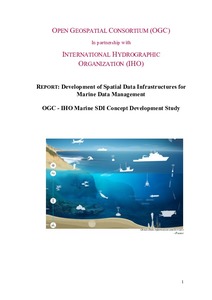
Development of Spatial Data Infrastructures for Marine Data Management; OGC - IHO Marine SDI Concept Development Study (CDS).
(Open Geospatial Consortium, Wayland, MA, 2019)This engineering report presents the results of a concept development study on a Marine Spatial Data Infrastructure (SDI), sponsored by the National Geospatial- Intelligence Agency (NGA) - Maritime Safety Office (MSO), ... -
Reference Model for the ORCHESTRA Architecture (RM-OA). Version 2 (Rev 2.1).
(Open Geospatial Consortium, Wayland, MA, 2007)This document specifies the Reference Model for the ORCHESTRA Architecture (RM-OA). It is an extension of the OGC Reference Model and contains a specification framework for the design of geospatial service-oriented ... -
OGC Common DataBase Volume 2 Appendices. Version 1.0.0.
(Open Geospatial Consortium, Wayland, MA, 2015)The full CDB specification, in its current, industry-maintained format and version, addresses the interoperability challenge of full plug-and-play interoperability and re-use of synthetic environment databases used for ... -
OGC Common DataBase Volume 1 Main Body. Version 1.0,0.
(Open Geospatial Consortium, Wayland, MA, 2015)The Common DataBase (CDB) Specification provides the means for a single, versionable, simulation-rich, synthetic representation of the earth. A database that conforms to this Specification is referred to as a Common DataBase ... -
OGC IOGP/IPIECA Recommended Practice for a Common Operating Picture for Oil Spill Response. Version 1.0.
(Open Geospatial Consortium, Wayland, MA, 2015)Responding to an oil spill requires access to and understanding of many types of information. Effective, coordinated operations for the response are based on a shared, common picture of the situation. Interoperability ... -
DGIWG – Web Map Service 1.3 Profile – Revision. Version 2.0.
(Open Geospatial Consortium, Wayland, MA, 2016)This document defines specific DGIWG requirements, recommendations and guidelines for implementations of the ISO / OGC Web Map Service standard which is based on ISO 19128:2005 Web Map Server Interface / OpenGIS Web Map ... -
DGIWG – Web Feature Service 2.0 Profile. Version 2.0.
(Open Geospatial Consortium, Wayland, MA, 2016)This document defines the DGIWG profile for the ISO 19142:2010 - Web Feature Service (WFS) including changes made in the OpenGIS Web Feature Service 2.0 Interface Standard - Corrigendum. The Web Feature Service provides ... -
Volume 2: OGC CDB Core: Model and Physical Structure: Informative Annexes. Version 1.0.
(Open Geospatial Consortium, Wayland, MA, 2017)This document provides the Annexes for the CDB Core: Model and Physical Structure standard. The only exception is Annex A, Abstract Test Suite. The CDB ATS Annex is in Volume 1: Core document. -
Volume 7: OGC CDB Data Model Guidance Formerly Annex A Volume Part 2. Version 1.0.
(Open Geospatial Consortium, Wayland, MA, 2017)This CDB Volume provides Guidelines, Clarifications, Rationales, Primers, and additional information for the definition and use of various models that can be stored in a CDB compliant data store. Please note that the term ... -
Volume 12: OGC CDB Navaids Attribution and Navaids Attribution Enumeration Values. Version 1.0.
(Open Geospatial Consortium, Wayland, MA, 2017)This OGC Best Practice, a volume of the CDB document set, provides a list and description of the instance-level attribution fields held in Navigation Dataset Instance Attribute files. Please refer to section 3.7 of the CDB ... -
OGC Moving Features Encoding Extension - JSON. Version 1.0.
(Open Geospatial Consortium, Wayland, MA, 2017)This document proposes a JavaScript Object Notation (JSON) encoding representation of movement of geographic features as an encoding extension of OGC Moving Features ([OGC 14-083r2] and [OGC 14-084r2]). A moving feature, ... -
JSON Encoding Rules SWE Common / SensorML. Version 1.0.
(Open Geospatial Consortium, Wayland, MA, 2018)This document describes new JavaScript Object Notation (JSON) encodings for the Sensor Web Enablement (SWE) Common Data Model and the Sensor Model Language (SensorML). Rather than creating new JSON schemas, this document ... -
OGC Best Practice for using Web Map Services (WMS) with Ensembles of Forecast Data. Version 1.0.
(Open Geospatial Consortium, Wayland, MA, 2018)This document proposes a set of best practices and guidelines for implementing and using the Open Geospatial Consortium (OGC) Web Map Service (WMS) to serve maps which are members of an ensemble of maps, each of which is ... -
Web Feature Service Implementation Specification, Verson 1.1.0.
(Open Geospatial Consortium, Wayland, MA, 2005)The Open Geospatial Consortium (OGC) has developed a member consensus that when software vendors implement their products in compliance with open geospatial web service interface and data encoding specifications, end-users ... -
Web Map Context Documents. Version 1.1.0.
(Open Geospatial Consortium, Wayland, MA, 2005)This document is the result of work begun during the first and second OGC Web Mapping Testbeds in 1999 and 2000 by IONIC Software and the US National Aeronautics and Space Administration (NASA) and demonstrated by IONIC ... -
GML in JPEG 2000 for Geographic Imagery (GMLJP2) Encoding Specification. Version 1.0.0.
(Open Geospatial Consortium, Wayland, MA, 2006)The OpenGIS® GML in JPEG 2000 for Geographic Imagery Encoding Standard defines the means by which the OpenGIS® Geography Markup Language (GML) Standard http://www.opengeospatial.org/standards/gml is used within JPEG 2000 ... -
Symbology Encoding Implementation Specification. Version 1.1.0. (revision 4).
(Open Geospatial Consortium, Wayland, MA, 2006)The OpenGIS® Symbology Encoding Standard (SES) defines an XML language for styling information that can be applied to digital geographic feature and coverage data. SE is independent of any OGC Web Services descriptions and ... -
Unified Geo-data Reference Model for Law Enforcement and Public Safety. Version 1.0.
(Open Geospatial Consortium, Wayland, MA, 2015)This document provides an overview of the Unified Geo-data Reference Model for Law Enforcement and Public Safety (Unified Model). The Unified Model was originally developed by the GIS Center for Security (GIS CS), Abu Dhabi ... -
OGC OpenSearch Extension for Earth Observation Satellite Tasking: Best Practice. Version 1.0.
(Open Geospatial Consortium, Wayland, MA, 2014)This document provides a specification of an OpenSearch extension for Earth Observation Satellites Tasking. This OGC Best Practice is intended to provide a very simple way to task Earth Observation (EO) satellites ... -
WaterML-WQ - an O&M and WaterML 2.0 profile for water quality data. Version 1.0.
(Open Geospatial Consortium, Wayland, MA, 2014)This Best Practice describes how to configure XML documents for single and time series water quality measurements. In addition to stating the rules for using the O&M and WML 2 standards, along with the appropriate content ...