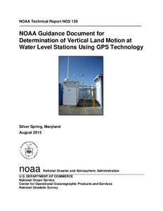
| dc.contributor.author | Gill, S. | |
| dc.contributor.author | Weston, N. | |
| dc.contributor.author | Smith, D. | |
| dc.date.accessioned | 2018-12-12T19:51:44Z | |
| dc.date.available | 2018-12-12T19:51:44Z | |
| dc.date.issued | 2015 | |
| dc.identifier.citation | Gill, S.; Weston, N. and Smith, D. (2015) NOAA Guidance Document for Determination of Vertical Land Motion at Water Level Stations Using GPS Technology. Silver Spring, MD, NOAA National Ocean Service, 18pp. (NOAA Technical Report NOS 139). DOI: http://dx.doi.org/10.25607/OBP-147 | en_US |
| dc.identifier.uri | http://hdl.handle.net/11329/583 | |
| dc.identifier.uri | http://dx.doi.org/10.25607/OBP-147 | |
| dc.description.abstract | This document provides general guidance for the determination of vertical land motion at longterm
continuously operating water level stations, for the purpose of separating this signal from
relative water level change as measured at the water level station and the subsequent
determination of absolute water level change. While there are several ways to determine
absolute vertical land motion (within the context of a global terrestrial reference frame) that
affect a water level station, the most accurate methods or approaches all require the use of Global
Navigation Satellite System (GNSS) technology in some fashion. GNSS is a constellation of
satellites that are used to precisely determine the geographic location of a user's receiver
anywhere in the world. The GNSS includes satellite systems such as GPS, GLONASS
(Russian), Galileo (European), and others. Continuously operating long-term GPS systems that
use GNSS technology are generically referred to as cGPS or CORS stations.
This guidance is based on experiences and standard operating procedures of the NOAA NGSmanaged
network of Continuously Operating Reference Stations (CORS) and NOAA CO-OPSmanaged
National Water Level Observation Network (NWLON) and is targeted toward a
general audience. This guidance could also apply to any group wanting to establish a long-term
water level gauge and monitor the vertical land motion which affects it.
Water level stations provide information on long-term sea level variations relative to the local
land (specifically the motion of land upon which the water level station and local benchmarks
rest). For many coastal applications, knowledge of relative sea level change is of primary
importance to understand how the sea is changing relative to the land for coastal inundation and
maritime charting and mapping purposes, among others.
GPS measurements (either through a permanent, continuously operating long-term GPS
reference station (cGPS), or through episodic GPS static re-surveys of the same point) provide
information on long–term variations in vertical and horizontal land movement. For applications
pertaining to global sea level studies, it is necessary to ensure the two long-term measurements
have a common vertical survey tie so they have a common reference. The rates of relative sealevel
change can then be directly related to the vertical velocities of the local land. After careful
adjustment of the sea level data for vertical land motion over time, an absolute rate of sea-level
change (though still geographically dependent on the location of the water-level station) can be
determined and the sea level data becomes more useful for understanding regional and global
sea-level change and has been applied to various global sea level reconstructions (Ray and
Douglas, 2011; Jevrajeva, 2014). | en_US |
| dc.language.iso | en | en_US |
| dc.publisher | NOAA, National Ocean Service | en_US |
| dc.relation.ispartofseries | NOAA Technical Report NOS;139 | |
| dc.rights | CC0 1.0 Universal | * |
| dc.rights.uri | http://creativecommons.org/publicdomain/zero/1.0/ | * |
| dc.subject.other | Water level | en_US |
| dc.title | NOAA Guidance Document for Determination of Vertical Land Motion at Water Level Stations Using GPS Technology. | en_US |
| dc.type | Report | en_US |
| dc.description.status | Published | en_US |
| dc.format.pages | 18pp. | en_US |
| dc.description.refereed | Refereed | en_US |
| dc.publisher.place | Silver Spring, MD | en_US |
| dc.rights.license | Public Domain | |
| dc.description.currentstatus | Current | en_US |
| dc.description.eov | Sea surface height | en_US |
| dc.description.bptype | Best Practice | en_US |
| dc.description.bptype | Guide | en_US |
| obps.contact.contactemail | coops.webmaster@noaa.gov | |
| obps.resourceurl.publisher | https://tidesandcurrents.noaa.gov/pub.html | en_US |
 Repository of community practices in Ocean Research, Applications and Data/Information Management

