Search
Now showing items 1-9 of 9

Wave Measurements from Radar Tide Gauges.
(2019)
Currently the NOAA Center for Operational Oceanographic Products and Services
(CO-OPS) is transitioning the primary water level sensor at most NWLON stations,
from an acoustic ranging system, to microwave radars. With ...

Sensor Specifications and Measurement Algorithms.
(NOAA, NOS Center for Operational Oceanographic Products and Services, Silver Spring, MD, 2015)
Environmental Measurement Systems.
User’s Guide to Vertical Control and Geodetic Leveling for CO-OPS Observing Systems.
(NOAA, NOS Center for Operational Oceanographic Products and Services, Silver Spring, MD, 2018)
The National Ocean Service (NOS) Center for Operational Oceanographic Products and Services
(CO-OPS) is responsible for the management of a national water level measurement program.
The foundation of this program is the ...

Test and Evaluation Report Limited Acceptance of the Design Analysis WaterLog® H-3611i Microwave Radar Water Level Sensor.
(NOAA, NOS Center for Operational Oceanographic Products and Services, Silver Spring, MD, 2011)
The National Oceanic and Atmospheric Administration (NOAA) National Ocean Service (NOS)
Center for Operational Oceanographic Products and Services (CO-OPS) is responsible for
developing and maintaining the National Water ...

Water Level and Wave Height Estimates at NOAA Tide Stations from Acoustic and Microwave Sensors.
(NOAA, NOS Center for Operational Oceanographic Products and Services, Silver Spring, MD, 2014)
The National Oceanic and Atmospheric Administration (NOAA) Center for Operational
Oceanographic Products and Services (CO-OPS) is transitioning the primary water level sensor
at the majority of tide stations in the ...
A Comparison of Datums Derived from CO-OPS Verified Data Products and Tidal Analysis Datum Calculator.
(NOAA, NOS Center for Operational Oceanographic Products and Services, Silver Spring, MD, 2017)
The NOAA National Ocean Service Center for Operational Oceanographic Products and
Services (CO-OPS) has developed a publicly accessible tool to compute tidal datums from water
level data with a variety of tidal signals. ...

A Guide to CO-OPS SHEF and CREX Products (2001 Revised 2013).
(NOAA, NOS Center for Operational Oceanographic Products and Services, Silver Spring, MD, 2013)
The Center for Operational Oceanographic Products and Services (CO-OPS) within the National Ocean Service (NOS) provides real-time oceanographic and meteorological information to meet its mission of supporting safe and ...
Error Analysis Procedures Used by the National Ocean Service to Compute Estimated Error Bounds for Tidal Datums in the Arctic Ocean.
(NOAA, NOS Center for Operational Oceanographic Products and Services, Silver Spring, MD, 2014)
NOAA has an established National Water Level Observation Network (NWLON) along all U.S.
coastlines. One purpose of the NWLON is to provide control for tidal datum determination at
short-term water level stations ...
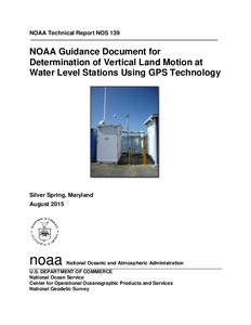
NOAA Guidance Document for Determination of Vertical Land Motion at Water Level Stations Using GPS Technology.
(NOAA, National Ocean Service, Silver Spring, MD, 2015)
This document provides general guidance for the determination of vertical land motion at longterm
continuously operating water level stations, for the purpose of separating this signal from
relative water level change ...