Browsing ⇒ JCOMM: Joint Tech Comm for Oceanography & Marine Meteorology by Title
Now showing items 9-28 of 29
-
Guide to Data Collection and Location Services using Service Argos. Revision 1.
(WMO and IOC, Data Buoy Cooperation Panel, 2011)The Argos system locates fixed and mobile platforms and collects environmental data from them. The system was developed under a co-operative programme between the French Space Agency (CNES, France), the National Aeronautics ... -
Ice Chart Colour Code Standard, Version 1.0, 2014.
(World Meteorological Organization & Intergovernmental Oceanographic Commission, Geneva, Switzerland, 2014)This document describes two separate colour codes for use on ice charts: the first one based on total concentration (CT) intended for use when the stage of development is relatively uniform but concentration is highly ... -
IHO Standards for Hydrographic Surveys, Edition 6.0.0 September 2020.
(International Hydrographic Organization, Monaco, 2020)This publication aims to provide a set of standards for hydrographic surveys primarily used to compile navigational charts essential for the safety of navigation, knowledge and the protection of the marine environment. It ... -
JCOMM Data Management Plan.
(WMO & IOC, Geneva, 2015)JCOMM was established by the World Meteorological Organization (WMO) and UNESCO's Intergovernmental Oceanographic Commission (IOC) in 1999 to be their major advisory body on all technical aspects of operational marine ... -
Manual on Sea-level Measurements and Interpretation, Volume V: Radar Gauges. [includes Supplement Practical Experiences]
(Intergovernmental Oceanographic Comission of UNESCO, Paris, France, 2016)Volume 5 which is devoted specifically to ‘Radar Tide Gauges’. Radar range finders have been used in industry (where they measure the levels of liquids in tanks) and hydrology (for measuring river, lake and reservoir ... -
An Oceanographers’ and Marine Meteorologists’ Cookbook for Submitting Data and Metadata in Real-time and Delayed Mode.
(Joint Technical Commission for Oceanography and Marine Meteorology (JCOMM), Geneva, Switzerland, 2015)There are many marine meteorological and oceanographic (met-ocean) observations which are not currently contributing to WMO and IOC Applications. Several reasons may explain the situation, including for example reluctance ... -
Oceanographic and Marine Meteorological Observations in the Polar Regions - A report to the Joint WMO-IOC Technical Commission for Oceanography and Marine Meteorology.
(WMO & IOC, Observations Coordination Group (OCG), 2000)In Geneva, December 6-8, 1999, a meeting of experts was held to discuss a JCOMM/GOOS Polar Region Strategy. It was agreed on the importance of developing an integrated Polar Region Strategy Document for JCOMM. This document ... -
Proceedings of the Ice Analysts Workshop, Rostock, Germany, 12-17 June 2008.
(WMO & IOC, Geneva, 2008)These are the Proceedings of the Ice Analysts Workshop, Rostock, Germany, 12-17 June 2008. CD ROM and available ftp://ftp.wmo.int/Documents/PublicWeb/amp/mmop/documents/JCOMM-TR/J-TR-43-IAW-2008/. -
Recommended algorithms for the computation of marine meteorological variables
(Joint Technical Commission for Oceanography and Marine Meteorology (JCOMM), Geneva, Switzerland, 2015)A range of variables observed under the Voluntary Observing Ship (VOS) scheme, and circulated over the Global Telecommunication System (GTS) in real-time (RT), or exchanged internationally in delayed mode (DM), may be ... -
SIGRID-3 : a vector archive format for sea ice georeferenced information and data. Version 3.0.
(WMO & IOC, Geneva, Switzerland, 2014)This document describes Version 3.0 of SIGRID-3 (Sea Ice GeoReferenced Information and Data), an evolution of the SIGRID series of standards for coding, exchange and archiving of digital ice charts. Version 3.0 retains ... -
SOOP Basic ship visit and rider rules. [NO LONGER ABLE TO LINK TO THIS]
(SOT, WMO & IOC, 2003)The following guidelines pertain to any person who might have occasion to visit, install, repair or replace equipment, or ride on any Voluntary Observing Ship (VOS) participating in any program to collect scientific ... -
SOT Recruitment presentation : Partnership between marine industry and the marine meteorological & oceanographic communities. Version 3, 2008.
(WMO & IOC, Geneva, Switzerland, 2008)This is a series of PowerPoint slides describing SOT VOS recruit information. Powerpoint presentation entitled "Partnership between Marine Industry and the Marine Meteorological and Oceanographic Communities" to be used ... -
Techniques and Benefits of Satellite Data and Wave Models.
(WMO & IOC, Geneva, Switzerland, 2006)This report documents techniques and benefits of satellite data in wind and wave models. It provides an overview of available satellite wind and wave data and their possible usage based on the questionnaire prepared by the ... -
The Voluntary Observing Ships Scheme: a framework document. Revision 2.
(Ship Observations Team, WMO & IOC, Geneva, Switzerland, 2010)Ships of the World Meteorological Organization (WMO) Voluntary Observing Ship (VOS) scheme have always been an important component of the global observing system of the WMO, providing meteorological ... -
User guide for thermosalinograph (TSG) installation and maintenance aboard a ship.
(JCOMM Ship Observations Team, 1999)Since 1990, the ECOP group (Etudes Climatiques de l'Ocean Pacifique tropical, former SURTROPAC group), IRD/Noumea, has been operating temperature and salinity measurements on board merchant vessels using thermosalinographs. ... -
Verification of operational global and regional wave forecasting systems against measurements from moored buoys.
(WMO & IOC, Geneva, 2006)The purpose of this JCOMM Technical Report is to document the global wave model verification activity, giving details of the working mechanism and file formats so that modeling centres not yet engaged may judge whether or ... -
Voluntary Observing Ships (VOS) Climate Subset Project (VOSCLIM) - Project Document, Revision 2.
(WMO & IOC, Ship Observations Team, Voluntary Observing Ship (VOS) Climate Project, 2002)This project document lists the primary objective is to provide a high-quality subset of marine meteorological data, with extensive associated metadata, to be available in both real time and delayed mode. Eventually, it ... -
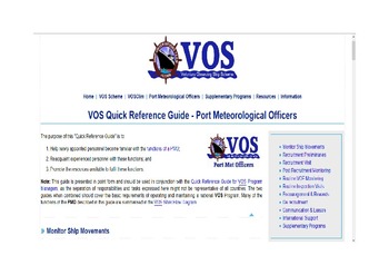
VOS Quick Reference Guide - Port Meteorological Officers. [Web document]
(JCOMM Ship Observations Team, 2017)The purpose of this "Quick Reference Guide" is to: Help newly appointed personnel become familiar with the functions of a PMO; Reacquaint experienced personnel with these functions; and Promote the resources ... -
The WMO Voluntary Observing Ships' Scheme.
(WMO-JCOMM, Geneva, Switzerland, 2010)The international scheme under which ships plying the various oceans and seas of the world are recruited for taking and transmitting meteorological observations is known as the WMO Voluntary Observing Ships’ Scheme. ... -
WOCE Sea Surface Salinity user's manual. Version 1.0. [17 Jun 2015]
(Ifremer/GOSUD, [Brest, France], 2015)This document is the WOCE-SSS data user's manual. It contains the description of the formats and netcdf files of the WOCE-SSS cd-rom