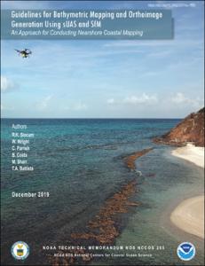
| dc.contributor.author | Slocum, R.K. | |
| dc.contributor.author | Wright, W. | |
| dc.contributor.author | Parrish, C. | |
| dc.contributor.author | Costa, B. | |
| dc.contributor.author | Sharr, M. | |
| dc.contributor.editor | Battista, T.A. | |
| dc.date.accessioned | 2021-08-05T20:26:34Z | |
| dc.date.available | 2021-08-05T20:26:34Z | |
| dc.date.issued | 2019 | |
| dc.identifier.citation | Slocum, R.K., Wright, W., Parrish,C., Costa, B., Sharr, M. and Battista, T.A. (2019) Guidelines for Bathymetric Mapping and Orthoimage Generation using sUAS and SfM: An Approach for Conducting Nearshore Coastal Mapping. Silver Spring, MD, NOAA NOS NCCOS, 83pp, (NOAA Technical Memorandum NOS NCCOS 265). DOI:10.25923/07mx-1f93 | en_US |
| dc.identifier.uri | https://repository.oceanbestpractices.org/handle/11329/1650 | |
| dc.identifier.uri | http://dx.doi.org/10.25607/OBP-1580 | |
| dc.description.abstract | The absence of accurate, contemporary, or detailed bathymetric data in nearshore coastal waters impedes coastal research, conservation, disaster response, planning, and management efforts. The use of small Unmanned Aircraft Systems (sUAS) and low cost RGB (red, blue, green) cameras, coupled with advanced
photogrammetry methods, structure from motion (SfM), provides a portable, efficient, rapid-response, and cost-effective method to fill nearshore data gaps. The sUAS–SfM approach provides an alternative method to traditional nearshore collection techniques, and is one that can benefit a diverse user community. The
digital elevation models (DEMs) and photomosaics that result from the sUAS-SfM approach can provide
users access to data of unparalleled resolution, previously unavailable. This methodology works well in environments with clear water, low wave conditions, and distinct visible features on the seafloor. Areas with poor water clarity, high wave conditions, breaking waves, or homogeneous sandy bottoms, are not well suited for this acquisition and processing methodology. Additionally, it is recommended that the sUAS platform selected be capable of acquiring a high accuracy trajectory (e.g., Carrier phase global
navigation satellite systems), in order to generate accurate data products. These recommendations, and others introduced in this report are intended to encourage and aide the coastal mapping community in
implementation and further advancement of this technique. | en_US |
| dc.language.iso | en | en_US |
| dc.publisher | NOAA NOS NCCOS | en_US |
| dc.relation.ispartofseries | NOAA Technical Memorandum NOS-NCCOS; 265 | |
| dc.rights | CC0 1.0 Universal | * |
| dc.rights.uri | http://creativecommons.org/publicdomain/zero/1.0/ | * |
| dc.subject.other | Bathymetric data | en_US |
| dc.subject.other | Nearshore waters | en_US |
| dc.subject.other | Unmanned aircraft systems | en_US |
| dc.subject.other | Coastal mapping | en_US |
| dc.title | Guidelines for Bathymetric Mapping and Orthoimage Generation using sUAS and SfM: An Approach for Conducting Nearshore Coastal Mapping. | en_US |
| dc.type | Report | en_US |
| dc.description.status | Published | en_US |
| dc.format.pages | 83pp. | en_US |
| dc.description.refereed | Refereed | en_US |
| dc.publisher.place | Silver Spring, MD | en_US |
| dc.identifier.doi | 10.25923/07mx-1f93 | |
| dc.subject.parameterDiscipline | Other physical oceanographic measurements | en_US |
| dc.subject.instrumentType | cameras | en_US |
| dc.subject.instrumentType | bathymetric LiDARs | en_US |
| dc.subject.dmProcesses | Data acquisition | en_US |
| dc.description.currentstatus | Current | en_US |
| dc.description.sdg | 14.a | en_US |
| dc.description.eov | N/A | en_US |
| dc.description.maturitylevel | Mature | |
| dc.description.adoption | Organisational | en_US |
| dc.description.methodologyType | Method | en_US |
| dc.description.methodologyType | Specification of criteria | en_US |
| dc.description.methodologyType | Reports with methodological relevance | en_US |
| obps.endorsementAuthorDeclared.recommendedPractice | NOAA | |
| obps.contact.contactemail | tim.battista@noaa.gov | |
| obps.resourceurl.publisher | https://coastalscience.noaa.gov/data_reports/guidelines-for-bathymetric-mapping-and-orthoimage-generation-using-suas-and-sfm-an-approach-for-conducting-nearshore-coastal-mapping/ | |
 Repository of community practices in Ocean Research, Applications and Data/Information Management

