Browsing by Title
Now showing items 1995-2014 of 2049
-
Visibility Sensors Implementation Plan.
(NOAA, NOS Center for Operational Oceanographic Products and Services, Silver Spring, MD, 2009)The Federal Aviation Administration (FAA) has used visibility sensors at major airports for many years, but the requirement within the maritime industry came in 1980, when the MV Summit Venture hit the Sunshine Skyway ... -
A vision for FAIR ocean data products.
(2021)The ocean is mitigating global warming by absorbing large amounts of excesscarbon dioxide from human activities. To quantify and monitor the ocean carbonsink, we need a state-of-the-art data resource that makes data ... -
Visions for a Sea change: Report of the First International Workshop on Marine Spatial Planning, Intergovernmental Oceanographic Commission and the Man and the Biosphere Programme UNESCO Headquarters. Paris, France. 8-10 November 2006.
(UNESCO, Paris, France, 2007)1 Introduction to the Workshop on Marine Spatial Planning 7 2 Introduction to Ecosystem-based, Sea Use Management 15 3 Ecosystem-based, Sea Use Management and Marine Spatial Planning 23 4 Key Scientific Issues for ... -
Volume 0: Primer for the OGC CDB Standard: Model and Physical Data Store Structure. Version 1.1.
(Open Geospatial Consortium, Wayland, MA, 2018)The CDB standard defines a standardized model and structure for a single, “versionable,” virtual representation of the earth. A CDB structured data store provides for a geospatial content and model definition repository ... -
Volume 10: OGC CDB Implementation Guidance, Version 1.1.
(Open Geospatial Consortium, Wayland, MA, 2018)This document provides detailed implementation guidance for developing and maintaining a CDB compliant data store. The CDB standard defines a standardized model and structure for a single, versionable, virtual representation ... -
Volume 11: OGC CDB Core Standard Conceptual Model. Version 1.0.
(Open Geospatial Consortium, Wayland, MA, 2017)This Open Geospatial Consortium (OGC) standard defines the conceptual model for the OGC CDB 1.0 Standard. The objective of this document is to provide an abstract core conceptual model for a CDB data store (repository). ... -
Volume 12: OGC CDB Navaids Attribution and Navaids Attribution Enumeration Values. Version 1.0.
(Open Geospatial Consortium, Wayland, MA, 2017)This OGC Best Practice, a volume of the CDB document set, provides a list and description of the instance-level attribution fields held in Navigation Dataset Instance Attribute files. Please refer to section 3.7 of the CDB ... -
Volume 1: OGC CDB Core Standard: Model and Physical Data Store Structure, Version 1.0.
(Open Geospatial Consortium, Wayland, MA, 2017)The CDB standard defines a standardized model and structure for a single, versionable, virtual representation of the earth. A CDB structured data store provides for a geospatial content and model definition repository ... -
Volume 2: OGC CDB Core: Model and Physical Structure: Informative Annexes. Version 1.0.
(Open Geospatial Consortium, Wayland, MA, 2017)This document provides the Annexes for the CDB Core: Model and Physical Structure standard. The only exception is Annex A, Abstract Test Suite. The CDB ATS Annex is in Volume 1: Core document. -
Volume 3: OGC CDB Terms and Definitions, Version 1.0.
(Open Geospatial Consortium, Wayland, MA, 2017)This CDB Volume provides terms and definitions. Many of the terms and definitions are specific to the simulation industry. Other terms and definitions have been updated to be consistent with the ISO 19xxx (Geomatics) ... -
Volume 5: OGC CDB Radar Cross Section (RCS) Models, Version 1.1.
(Open Geospatial Consortium, Wayland, MA, 2018)This CDB volume provides all of the information required to store Radar Cross Section (RCS) data within a conformant CDB data store. Please note that the current CDB standard only provides encoding rules for using ... -
Volume 6: OGC CDB Rules for Encoding Data using OpenFlight, Version 1.1.
(Open Geospatial Consortium, Wayland, MA, 2018)This volume defines the OpenFlight implementation requirements for a CDB conformant data store. Please also see Volume 1 OGC CDB Core Standard: Model and Physical Structure for a general description of all of the industry ... -
Volume 7: OGC CDB Data Model Guidance Formerly Annex A Volume Part 2. Version 1.0.
(Open Geospatial Consortium, Wayland, MA, 2017)This CDB Volume provides Guidelines, Clarifications, Rationales, Primers, and additional information for the definition and use of various models that can be stored in a CDB compliant data store. Please note that the term ... -
Voluntary Observing Ships (VOS) Climate Subset Project (VOSCLIM) - Project Document, Revision 2.
(WMO & IOC, Ship Observations Team, Voluntary Observing Ship (VOS) Climate Project, 2002)This project document lists the primary objective is to provide a high-quality subset of marine meteorological data, with extensive associated metadata, to be available in both real time and delayed mode. Eventually, it ... -
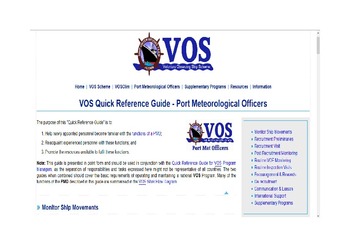
VOS Quick Reference Guide - Port Meteorological Officers. [Web document]
(JCOMM Ship Observations Team, 2017)The purpose of this "Quick Reference Guide" is to: Help newly appointed personnel become familiar with the functions of a PMO; Reacquaint experienced personnel with these functions; and Promote the resources ... -
Water Level and Wave Height Estimates at NOAA Tide Stations from Acoustic and Microwave Sensors.
(NOAA, NOS Center for Operational Oceanographic Products and Services, Silver Spring, MD, 2014)The National Oceanic and Atmospheric Administration (NOAA) Center for Operational Oceanographic Products and Services (CO-OPS) is transitioning the primary water level sensor at the majority of tide stations in the ... -
Water Quality Monitoring Field Manual.
(Yukon River Inter-Tribal Watershed Council , Science Department, Anchorage, Alaska, 2017)This manual is a reference tool for technicians conducting water sampling under the Yukon River Inter-Tribal Watershed Council (YRITWC) protocols. The YRITWC protocols were developed using the United ... -
WaterML-WQ - an O&M and WaterML 2.0 profile for water quality data. Version 1.0.
(Open Geospatial Consortium, Wayland, MA, 2014)This Best Practice describes how to configure XML documents for single and time series water quality measurements. In addition to stating the rules for using the O&M and WML 2 standards, along with the appropriate content ... -
Wave Energy Measurement Methodologies for IEC Technical Specifications. Open Sea Operating Experience to Reduce Wave Energy Costs Deliverable D5.1.
(University College Cork, Cork, Ireland, 2016)This document represents deliverable 5.1 (D5.1) of OPERA Work Package 5 (WP5). OPERA is a European Commission funded project that ultimately aims to reduce the time to market and costs of wave energy. OPERA WP5, entitled, ... -
Wave Measurements from Radar Tide Gauges.
(2019)Currently the NOAA Center for Operational Oceanographic Products and Services (CO-OPS) is transitioning the primary water level sensor at most NWLON stations, from an acoustic ranging system, to microwave radars. With ...